
 EN
EN
 ar
ar bg
bg hr
hr cs
cs da
da nl
nl fi
fi fr
fr de
de el
el hi
hi it
it ko
ko no
no pl
pl pt
pt ro
ro ru
ru es
es sv
sv tl
tl iw
iw id
id lv
lv lt
lt sr
sr sk
sk sl
sl uk
uk vi
vi et
et hu
hu th
th tr
tr fa
fa ms
ms hy
hy ka
ka ur
ur bn
bn mn
mn ta
ta kk
kk uz
uz ku
ku
Inclinometer
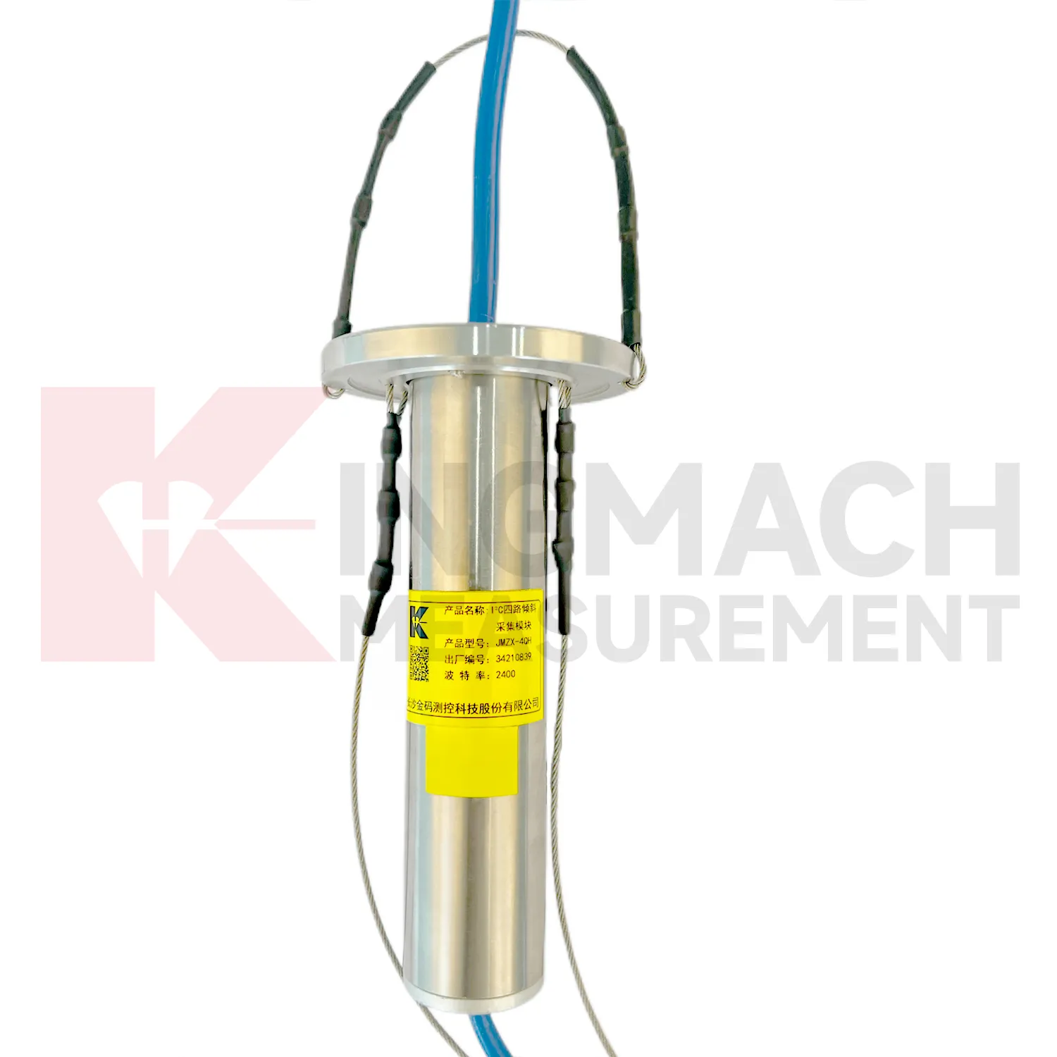
The JMZX-4QH acquisition module connects Kingmach Inclinometer into a multi-channel inclinometer data chain. It is used to collect measurement data from multi-point vertical in-place inclinometer strings and upload the data by wired or wireless means. Product details describe one controllable sensor power supply output, four downstream communication interfaces, automatic recognition, intelligent calculation after connection, and installation at the inclinometer tube orifice for waterproof and dustproof protection. The module supports up to 100 sensors through four channels. Published data includes DC 9V to 24V operating voltage, standby power below 0.5W, operation power below 4W, RS485 uplink communication with configurable baud rates, -30 degrees Celsius to +70 degrees Celsius operating temperature, about 70 mm length, about 1 kg weight, and IP67 protection. It is relevant when borehole sensors need organized power, communication, and upload control.
Application of Inclinometer
Port and underground construction projects use Inclinometer to follow soil movement, retaining structures, and deep displacement where surface survey alone is limited. JMZX-7100L is described for port engineering and underground construction projects, with Bluetooth communication, APP reading, large storage, and post-processing software. The sliding probe method is useful when engineers need a deformation profile along an inclinometer casing rather than one fixed surface angle. Field crews should keep casing ID, depth interval, probe orientation, reading direction, groundwater condition, and operator notes consistent. Data can then be compared with excavation, dredging, surcharge loading, pile work, or retaining wall movement. Good field discipline prevents a profile change from being confused with probe handling differences.
The future of Inclinometer
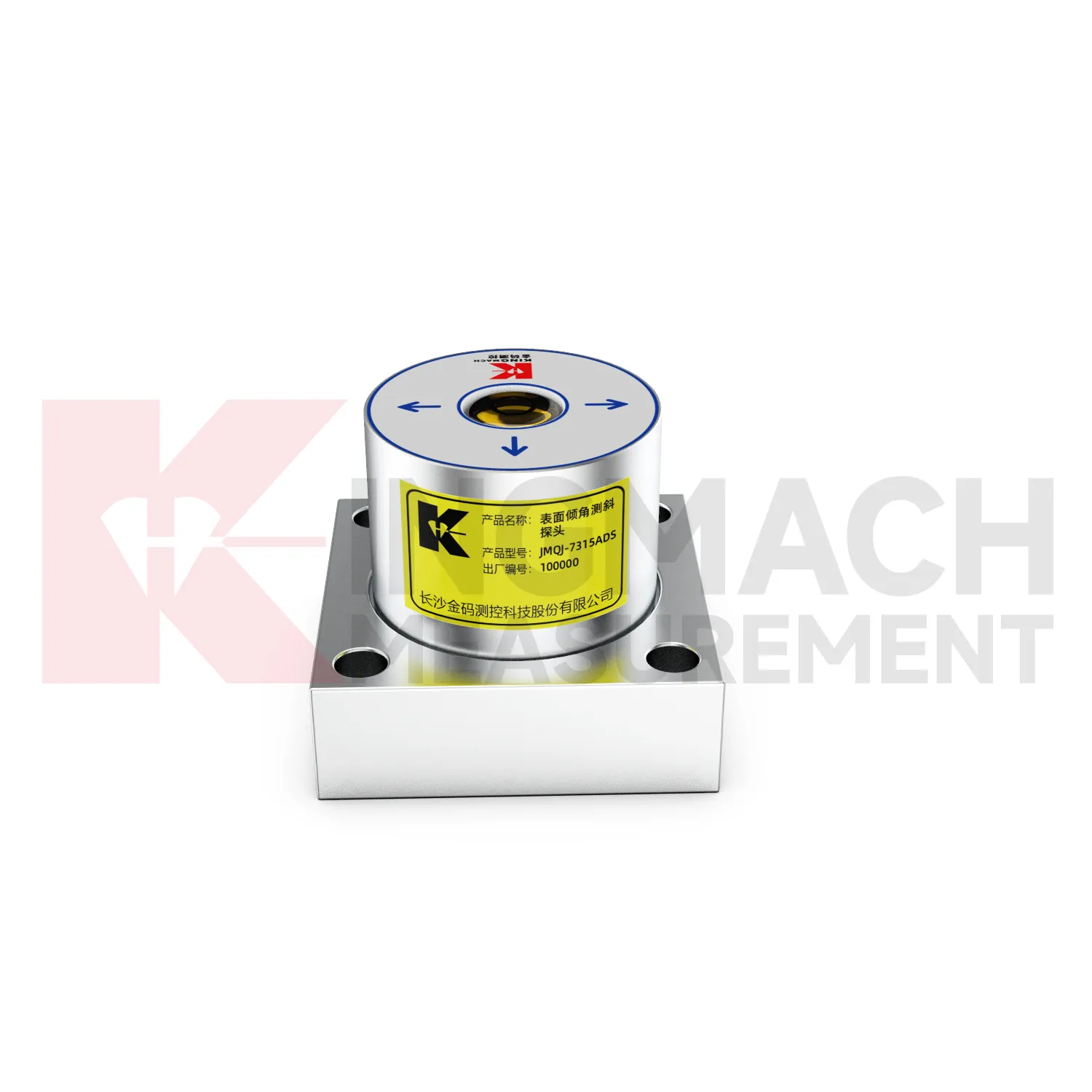
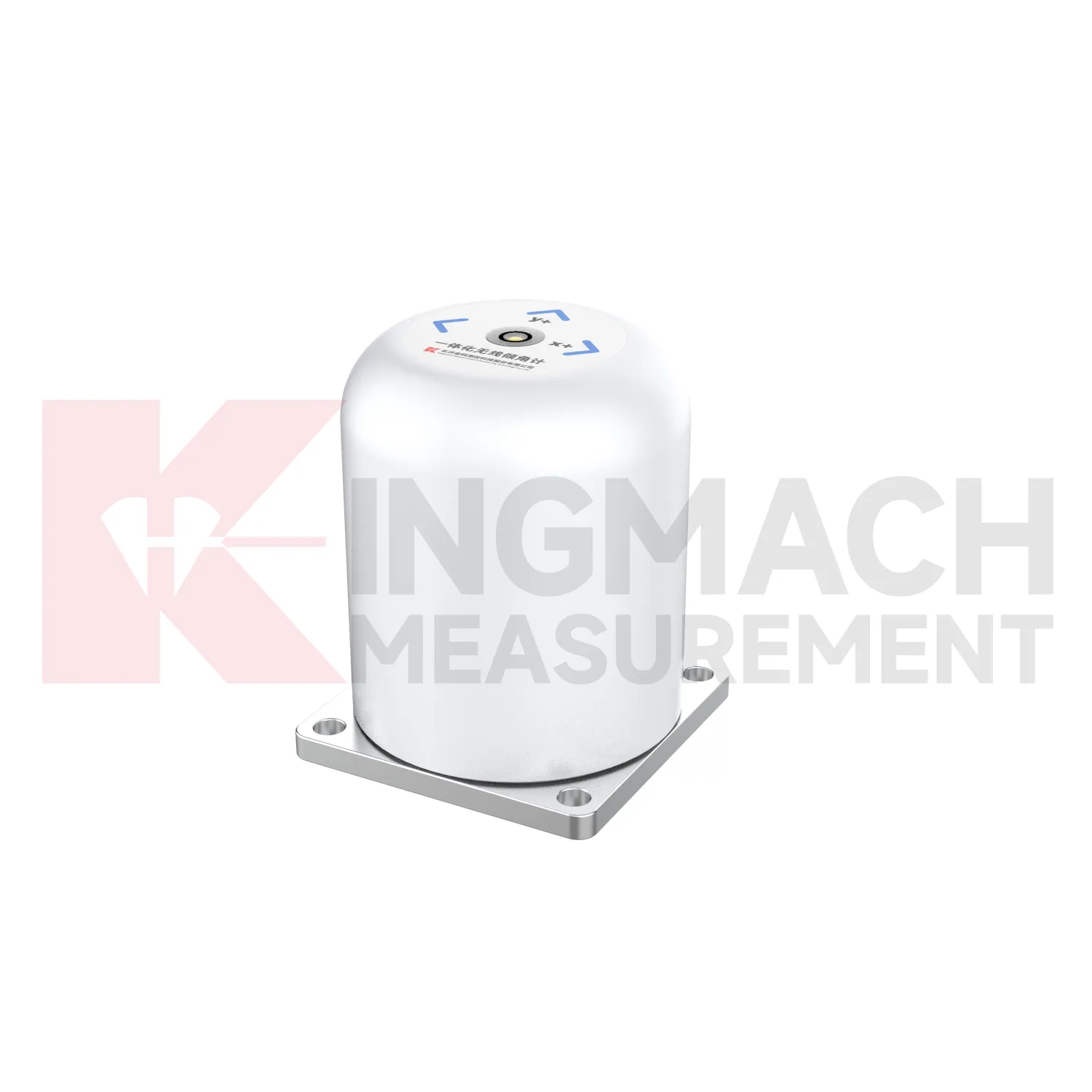
The future of Inclinometer will include stronger links to maintenance budgeting. Owners of bridges, railways, dams, tunnels, buildings, slopes, and towers need to rank which assets are stable and which require inspection or repair. Long-term tilt records can support that ranking when they are collected consistently and tied to structural locations. JMQJ-7315ADS, JMQJ-7315RTU, JMQJ-7915ATS, JMZX-7100L, and JMZX-4QH provide different paths for collecting angular or internal deformation data. Future asset systems can connect these records to inspection cycles, repair dates, weather events, and risk categories. The result is a tilt record that supports planning, not only construction-stage warnings.
Care & Maintenance of Inclinometer
Data review is part of maintaining Inclinometer. A curve should be checked for rate, direction, sudden jumps, missing values, repeated flatlines, and disagreement with nearby instruments. Compare tilt with settlement, displacement, strain, load, pore pressure, rainfall, vibration, and water level when available. For automated systems, verify channel names, units, time stamps, and alarm thresholds after platform changes. For manual readings, keep raw field notes and processed graphs together. If an alarm appears, inspect the mounting point, communication path, recent site work, and related instrument behavior. A good maintenance process treats data quality and field condition as one record, not two separate tasks.
Kingmach Inclinometer
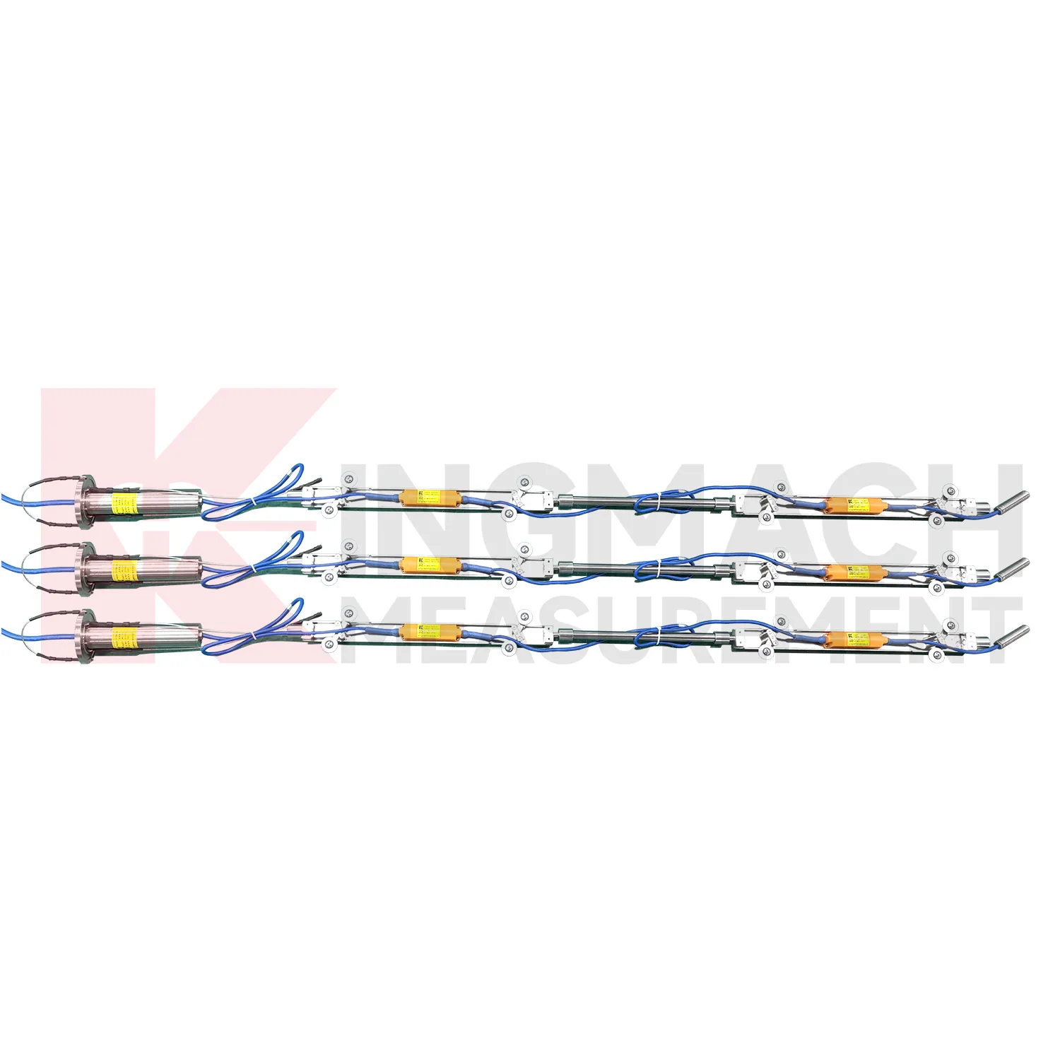
Kingmach Inclinometer support both surface structural tilt monitoring and deep internal deformation monitoring. Surface tilt instruments measure the angular change of buildings, bridges, railways, towers, walls, and equipment bases relative to the horizontal plane. Deep inclinometer systems, by contrast, follow angle changes inside soil or structural bodies through a borehole. The JMQJ-7915ATS vertical in-place inclinometer system uses a multi-array MEMS design, universal joints, connecting rods, and an orifice acquisition module to collect multi-point readings. This gives engineers a depth profile rather than one surface reading. That distinction is important in slopes, dams, embankments, foundation pits, and underground works. A surface point may remain calm while a deeper layer starts moving. Using the right tilt method makes the deformation pattern easier to locate.
FAQ
Q: How often should Inclinometer be inspected?
A: Inspection frequency depends on risk, access, construction stage, and deformation speed; active excavation or storm periods often need closer review.Q: What maintenance is needed for wireless tilt units?
A: Check battery status, antenna condition, upload timing, enclosure seals, point label, and platform channel naming.Q: What causes false tilt changes?
A: Loose mounting, disturbed cables, water entry, temperature effects, power faults, channel mistakes, or inconsistent manual reading can affect the record.Q: How should replacement be handled?
A: Record old and new model, serial number, range, baseline, reason, date, axis direction, channel name, and first stable value after replacement.Q: What makes tilt data useful over many years?
A: Consistent point naming, stable baselines, clear installation photos, protected hardware, visible maintenance records, and comparison with related site data.
Reviews
Christopher Martinez
Very satisfied with the readouts & data loggers. User-friendly interface and supports multiple sensor inputs.
Daniel Brown
Excellent environmental monitoring sensors. The data is consistent, and the system integrates smoothly with our existing setup.
Latest Inquiries
To protect the privacy of our buyers, only public service email domains like Gmail, Yahoo, and MSN will be displayed. Additionally, only a limited portion of the inquiry content will be shown.
Emma***@gmail.comCanada
Dear Sir/Madam, we are interested in displacement transducers and settlement sensors for a geotechni...
Sophia***@gmail.comUnited Kingdom
Good day, we need environmental monitoring sensors including temperature, humidity, and wind sensors...